KORSMAN CONSERVANCY
TOPOGRAPHY
and MAPS
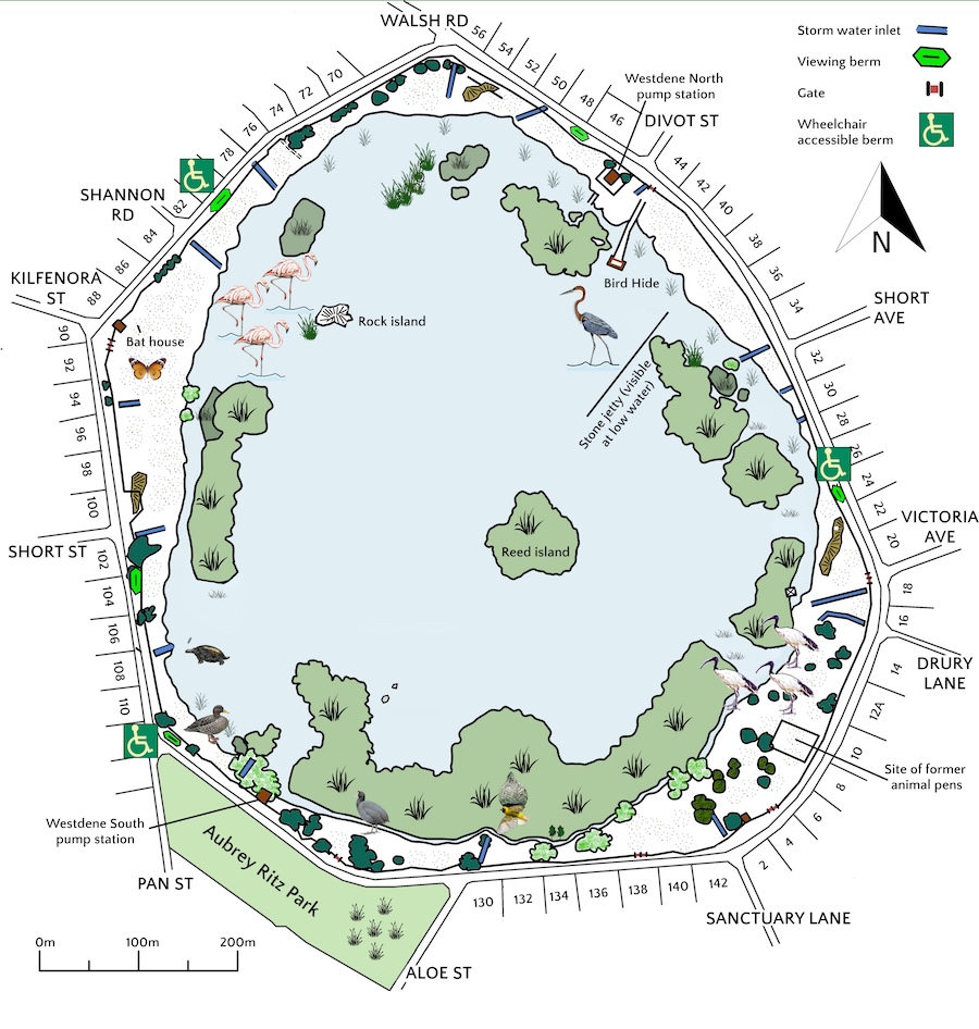
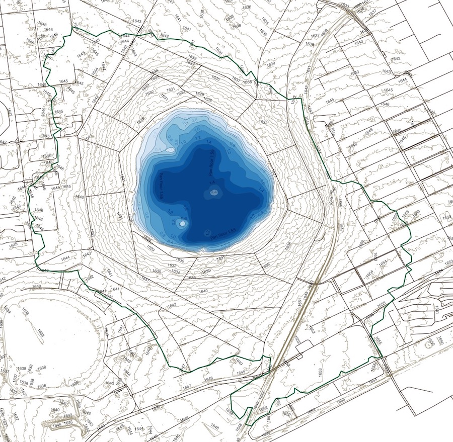
Korsman is a natural depression pan wetland. Altitude 1629m at water level. There is no natural outlet.
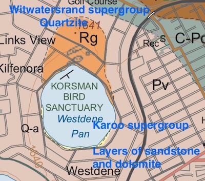
Biome and veld type: Mesic Highveld Grassland bioregion, vegetation type region Soweto Highveld Grassland and Eastern Temperate Freshwater Wetlands (Mucina and Rutherford 2006).
Climate: Subtropical summer rainfall region. Average rainfall 744mm per annum.
Average maximum temperature 21.9ᴼC per annum. Average minimum temperature 10.1ᴼC per annum.
The pan is fed by rainfall, storm water runoff and aquifers on the northeast and south of the pan.
The pan varies from 0 to 2.3m deep. It lies within a 230Ha subcatchment in the Blesbokspruit river system. Catchment area and bathymetric map below.